| | Published June 7th, 2023
| Lafayette's Utility Box Art celebrates over 175 years of history
| | | By Vera Kochan | 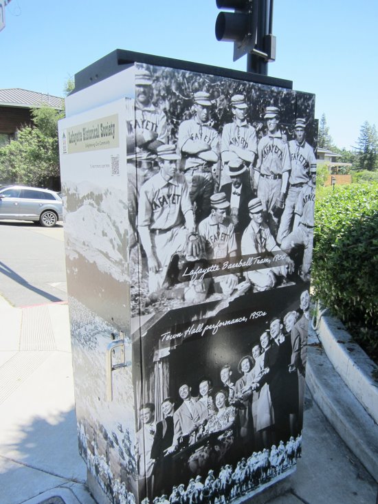 | | Leisure Pastimes Utility Box Art Photo Vera Kochan |
Lafayette's founder, Elam Brown, first arrived on Feb. 7, 1847 to check out the land grant that he and his wife, Margaret, had purchased. Originally called Rancho Acalanes, the 3,300 acres grew to become the bustling city that is today's Lafayette.
 This past February, the Lafayette Historical Society (LHS) in conjunction with the city's Public Art Committee chose graphic designer Danielle Gogo-Gallagher to create seven examples of photo-wrapped utility boxes depicting historical snapshots in time throughout Lafayette's 175 years. Each box is located along Mt. Diablo Boulevard, at seven different intersections along an approximately 0.8-mile stretch of road (between First Street and Delores Drive). Once you know what you're looking for, finding the boxes is not difficult.
 ? A QR code is located on each box that can be scanned using a smartphone. This feature connects to a short LHS presentation that explains the historical relevance of each particular utility box's images and includes more archival photos. For example, the "Saklan People" box takes viewers back in time when the Bay Miwok tribe first inhabited the area thousands of years ago. How they looked, what they wore, how they hunted, what they ate, and their homes are discussed.
 An "Early Downtown" box helps to explain Lafayette's first settlers and the businesses that were available during the late 1800s. A grist mill, hotels, a store, a blacksmith shop, and a school were the first signs of retail activity. A few decades later a church and post office were added.
 ? The "Pioneer & Farm Life" box reveals how and when the first farmers arrived and would eventually grow crops that included pears, peaches, walnuts and grapes. Many farmers also kept cows on their property and made their own butter and cheese from the milk.
 The "Mt. Diablo Boulevard" box lets viewers know that the main road was still unpaved by 1926, even though cars were beginning to travel on it right alongside cattle. Ten years later, the main streets were paved and included lane lines, but drivers, as yet, had no traffic signs or signals to deal with. As the decades passed, additional lanes were added and more businesses came to Lafayette.
 An "Early School Days" box explains the 1850s opening of the first grammar school and subsequent schools to follow. One of the teachers, Jennie Bickerstaff, arrived to work each day riding sidesaddle on her horse due to the long skirts women wore at the turn of the last century.
 Not to be left out is the "Leisure Pastimes" box. Lafayette worked hard and played hard by enjoying sports (there was a baseball team), May Day and Fourth of July events, community dances, horse shows, and in 1941, the opening of the Park Theatre for movies.
 Situated at the crossroads of Martinez, Canyon/Moraga, Oakland and Walnut Creek, the "Tunnels, Roads & Rails" box denotes the importance of enhanced travel routes for Lafayette's citizens. The 1913 electric railroad service through town, the 1937 opening of what would eventually become the Caldecott Tunnel, and the building of Highway 24 in the 1960s would serve to connect Lafayette with its neighbors and beyond.
 For more information or to take the tour visit: www.lovelafayette.org/175plus. You can also visit the LHS website: www.lafayettehistory.org or https://facebook.com/LafayetteHistoricalSociety.
 Special thanks to LHS Oral History and Social Media Director John Kennett.
 |
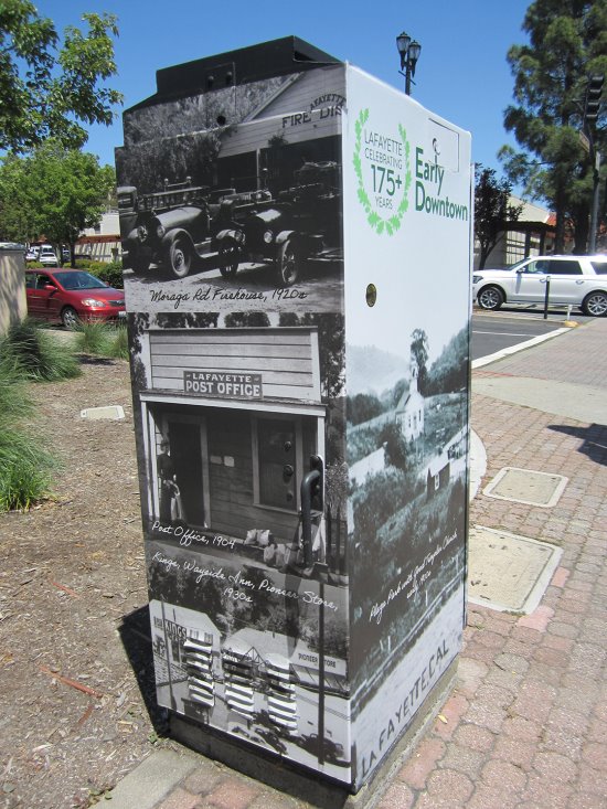 | | Early Downtown Utility Box Art Photo Vera Kochan | 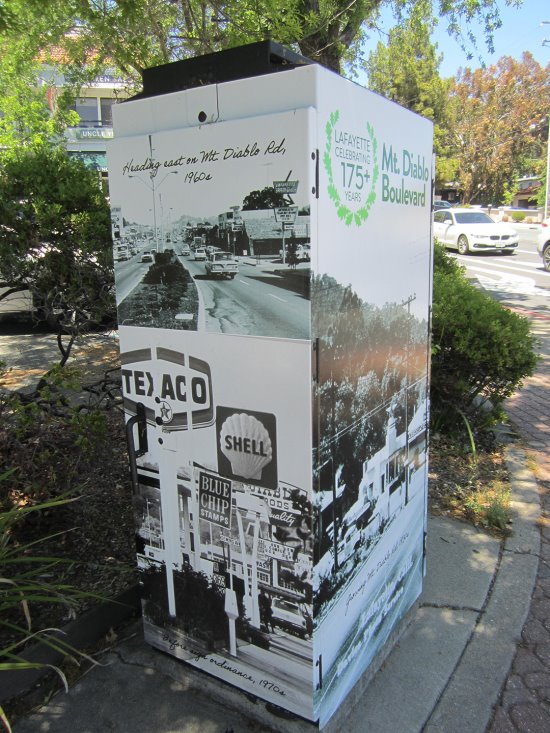 | | Mt Diablo Boulevard Utility Box Art Photo Vera Kochan | 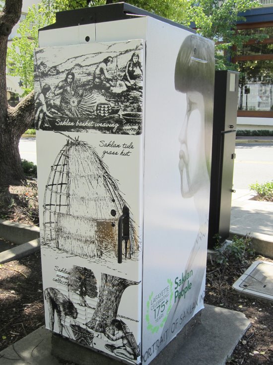 | | Saklan People Utility Box Art Photo Vera Kochan | | | | | | | |


